
Maps Excite the Imagination, Lead to Unknown Destinations


----
By Victor Block
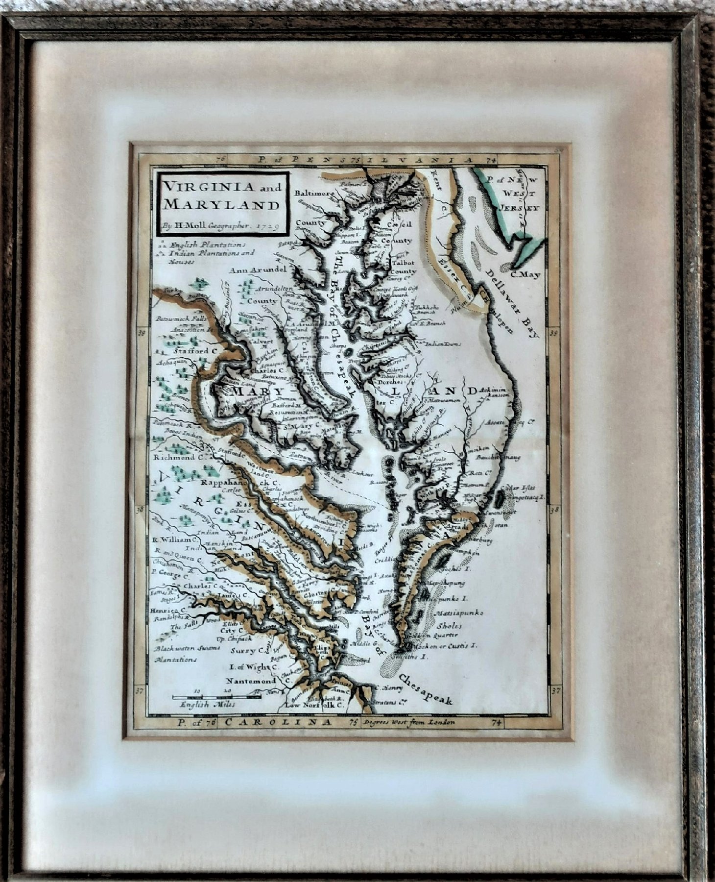
As I peer at a wall-hanging in my living room, I picture men in Colonial attire smoking long clay pipes, women wearing ankle-length prairie dresses and Native Americans using primitive implements to plant corn and other crops. The framed image isn't a drawing or painting but rather a small map. Some features are highlighted in hand-applied colors, and figures identify "English Plantations" and "Indian Plantations and Houses." Written in the upper left corner is "H. Moll. 1729."
This hand-drawn map of Maryland and Virginia was the work of Herman Moll, a well-known cartographer who lived in London. In the place spelling of that time, today's Chesapeake Bay is called "The Bay of Chesapeak," and the Potomac River is identified as "Patowmack."
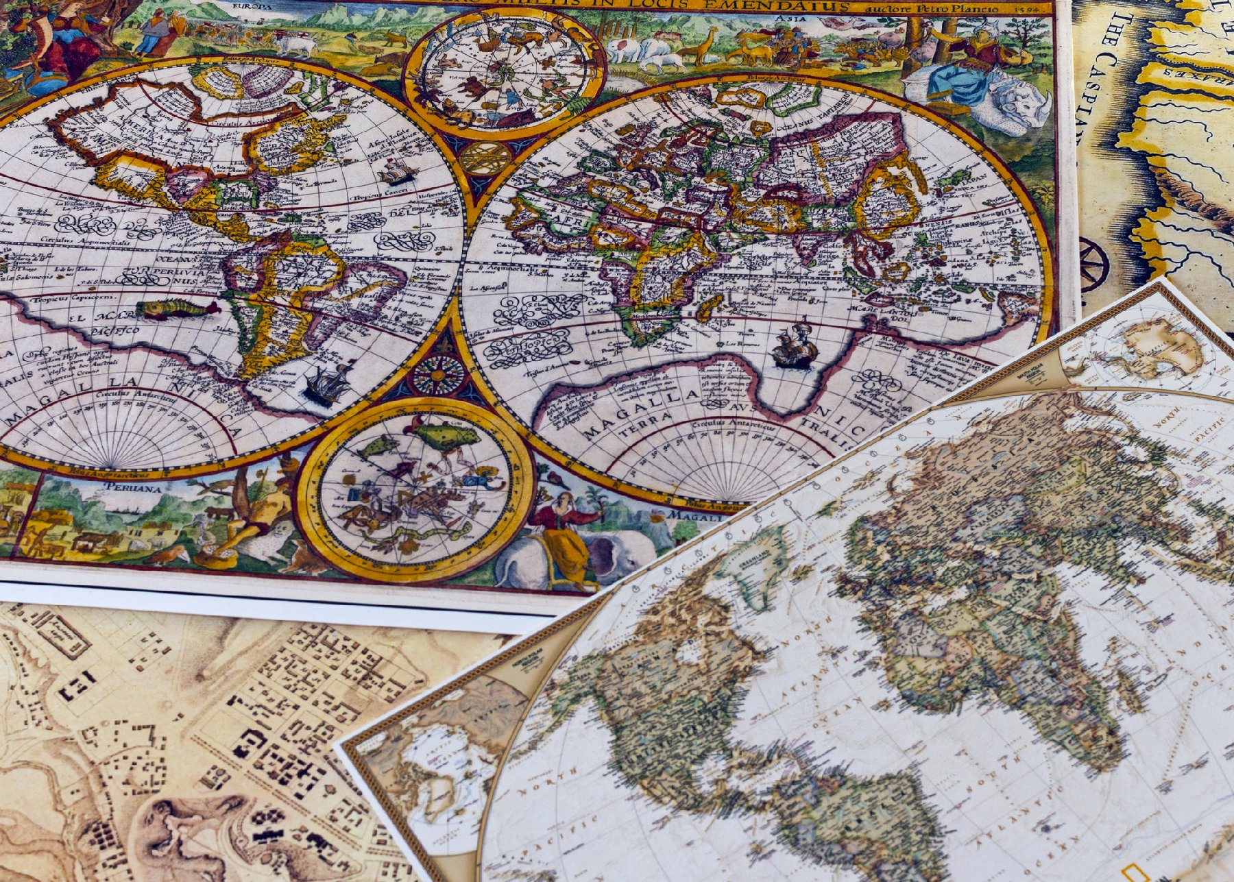
This map and countless others can transport us to distant places and centuries long past. These diagrams can serve as magic carpets that take our minds, if not our bodies, on journeys around the country and the world as well as back in history. For some people maps serve as collectible time capsules that conjure up memories of childhood. Others view them as windows into the world as it was -- or was depicted --eons ago.
Depending upon your age, you might recall strip maps that were available from automobile clubs and accordion-folded diagrams that gas stations provided free to travelers who purchased fuel. Today these have been succeeded by the likes of MapQuest, Google Maps and cellphone devices. While I use them all, online depictions and directions along with the emotionless voice emanating from my phone lack the memories, nostalgia and sense of discovery I get from perusing a map of just about anywhere.
How did No Name, Colorado; Embarrass, Minnesota; and Accident, Maryland, come to be called that? What lies just off the highly trafficked interstate highways that warrants a detour?
Maps can help provide answers to questions and enhance the experience of driving cross-country or even in or near where you live. They also can offer a history lesson, introduce a fascinating look into the intellect and beliefs of each period of the past, and in some cases add an amusing interlude.
The map that some scholars believe is the oldest in the world could hardly have been taken on such a trip. It's a 9-foot-wide drawing on the wall of a cave in what now is Turkey. Dated between 6300 and 6100 B.C., the rendering is thought to represent an ancient city that had a volcano and about 80 buildings.
In the sixth century B.C., the Greek scientist Anaximander created what's believed to be the first world map. In his view, the earth was shaped like a cylinder and humans lived on the flat top portion.
Other inventions and iterations followed. Between 700 and 500 B.C., a small clay tablet placed the city of Babylon at the center of the world and broke new ground, literally, by including islands.
In a book titled "History of the World in 12 Maps," British Renaissance studies professor Jerry Brotton discusses the impact of maps over the ages from the almost mystical representations of ancient times to present-day satellite-created imagery. Chapters that cover pivotal periods in history include a Christianity-oriented map from an English cathedral (1300) that depicts the Garden of Eden, Jerusalem and Jesus; another by a German cartographer (1507) that was the first to recognize the continent of America; and Flemish mapmaker Gerardus Mercator, who first projected the earth's curvature onto a flat piece of paper.
Sometimes maps and mirth are wedded. That's true on the boredpanda.com website in a section called "40 Maps They Didn't Teach You in School." Among the irreverent representations are "The World According to Americans," in which the United States is "Land of Awesome," Canada is known as "Fur Trappers" and Australia "Kangaroo Riders." According to "If U.S. Cities Kept their Original Names," New York would be New Amsterdam and Rapid City, South Dakota, would have its unfortunate former name -- Hay Camp.
Some people use maps to seek out landmarks that lie off major highways and to follow random roads to discover what hidden treasures might lie ahead. For them, old maps are treasures within themselves.
Some cities can even boast of museums where their collections include maps that encompass history, politics, creativity and artistic beauty. The Osher Map Library in Portland, Maine, is one such institution, and the Library of Congress also has an impressive collection. There is even a digital online museum called The Museum of Maps.
Viewing maps at museums or creating your own collection can be enjoyable, educational and entertaining. It forces us to think about the vital role geographic charts once played in world history. It's also fun to dig up an old atlas or long-forgotten automobile map and use it to explore unknown territories on a driving trip. As an alternative, it can be a guide for a trip down memory lane.
----
WHEN YOU GO
boredpanda.com
oldmapsonline.org
themuseumofmaps.com
oshermaps.org
loc.gov/maps/collections
Victor Block is a freelance writer. To read features by other Creators Syndicate writers and cartoonists, visit the Creators Syndicate website at www.creators.com.
----
Copyright 2026 Creators Syndicate, Inc.
























Comments